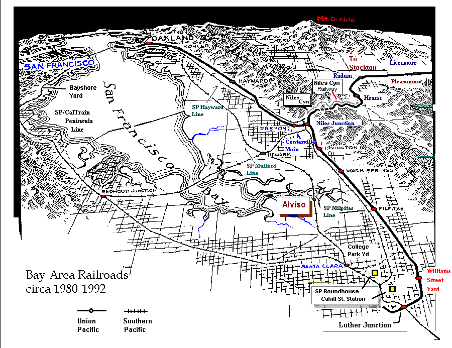
This is an Interactive Map of the Bay Area circa 1980-1992 and is meant to be a vehicle for navigating The Railroad Pages, at least as far as the Bay Area subjects are concerned. Click on a name to go to a page or web site related to that geographical area. This page is best viewed at a screen resolution of 1024x768 to minimize horizontal scrolling.